
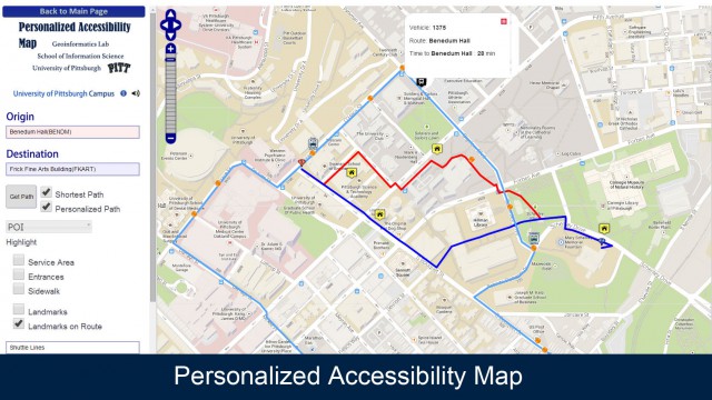
The Personalized Accessibility Map (PAM) is an interactive map that includes accessible information about sidewalks, paths and entrances and provides route options including walking and riding the shuttle bus. Developed by the researchers in the Geoinformatics Laboratory at the iSchool, PAM offers an unprecedented level of detail about navigating Pitt’s campus and the Oakland neighborhood.
Click here to use the Personalized Accessibility Map.